Sinkhole Data Visualization
The Office of Indigenous Knowledge and Innovation at the University of Hawaii has a fellowship program where each of the fellows gets partnered with a faculty member or community partner to develop an application that combines technology development and indigenous practices. The program is based out of the Create(X) Lab at the University of Hawaii at West Oahu campus, whose sister lab is the LAVA Lab at the University of Hawaii at Mānoa.
Starting in January of 2024, I was accepted into the program and paired with community member, Ulukoa Duhaylonsod, who has been a part of restoring a Hawaiian historical site that was once used for sinkhole agriculture. The program has partnered with Ulukoa to gain understanding of this area and the practice that comes with it, in order to develop a project that can be used for presentations to educate others as well as raise awareness and funding for the sinkhole site. Using the Makawalu VE developed in the LAVA Lab, we are able to modify the template provided and reframe it to fit the scope of this project. The goal is to create a touchscreen UI that works in tandem with wall and table projectors to display data regarding the sinkholes for easy presentation. The program uses the third party app, Epicollect5, for Ulukoa and others to use when collecting data in the field. This can then be exported as a json file which can be uploaded into the project for the corresponding data points to then be displayed. This is a project being continuously worked on with multiple iterations in development.
I am one of the co-designers and co-coders to this project along with my mentor Kari Noe. I have been involved in the design and development for this project which includes: going out into the field to discuss effective design implementations with those who will use this application, drafting multiple possible designs for data visualization, adjusting and adding to the the Makawalu VE code, and logging design notes as the project progresses. Some of the key skills I have gained from this project so far are UI/UX design, iterative and equitable design, project documentation, and familiarity with C# and Unity.
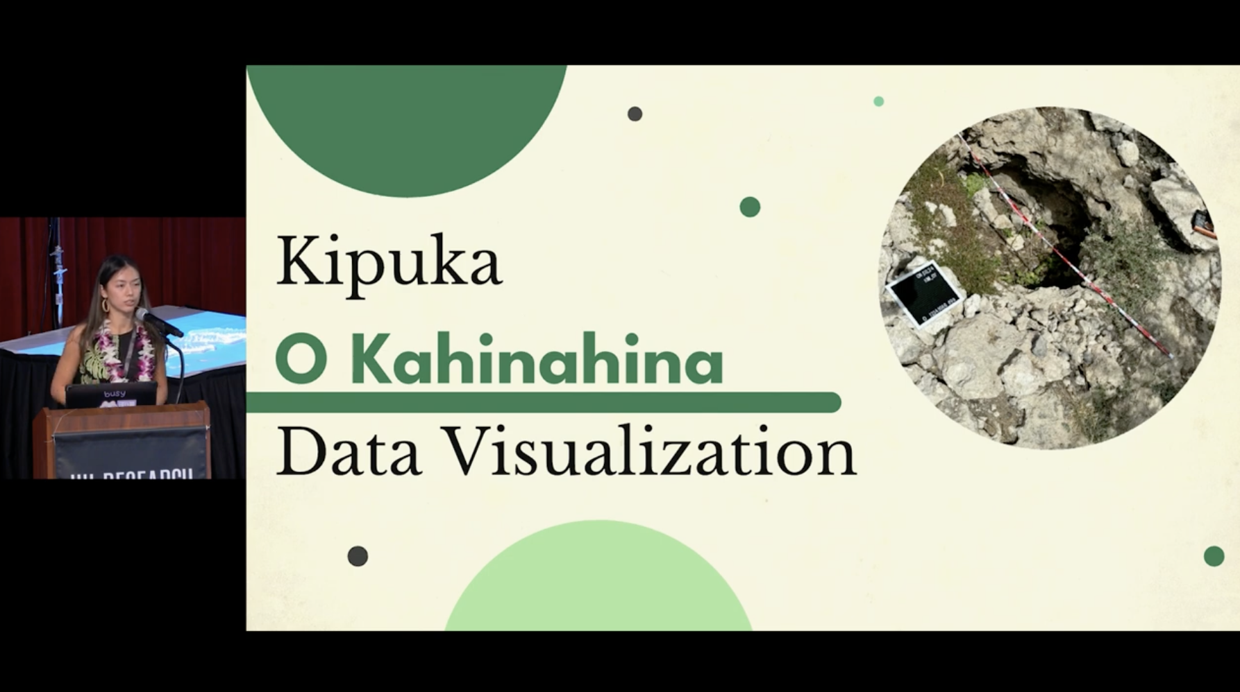
Kipuka O Kahinahina
Kipuka o Kahinahina is an endangered plant sanctuary located in the Kalaeloa area of Oʻahu. What makes this sanctuary stand out from others is the special landscape which allows the land to be productive and bountiful, despite the harsh arid climate of the Honouliuli area. Distinct to this area are the kālua, or sinkholes, formed in the coral grounds which provide many resources when nurtured correctly.
There are 3 main kālua to consider when entering this space:
- Kāluaʻolohe
- Kāluaʻolohe is the sinkhole landscape itself and ability to use traditional Native Hawaiian knowledge to thrive in such a landscape. Without this ancestral knowledge, it is easy to pass by the landscape and view it as a hostile and unproductive wasteland, as noted by past treatment of the Kipuka space by military parties and developers. All who would see the unique characteristics of the sinkhole landscapes, specifically the sinkholes, and fill it because they viewed it as obstructing possible development opportunities. However, the ancestors of Native Hawaiians understood the value that areas like this had, and were able to utilize the space to produce clean water and produce in which they would live off of.
- Kāluawai
- Kāluawai refer to the types of sinkholes that provided access to subterranean waters. These sinkholes produced clean water sources for those who lived in the hot, arid conditions of west Honouliuli on the island of Oʻahu. It was recorded by kūpuna that the kāluawai had ʻōpae ʻula in them, a Hawaiian shrimp, known to only live in clean and pollution free waters, which speaks to the pristine water quality these types of sinkholes were able to produce.
- Kāluamahi
- Kāluamahi refers to sinkholes that were utilized for agricultural purposes in the Kalaeloa area on Oʻahu. It has been recorded that ancient Hawaiians tended varios flora in these kāluamahi. Some examples consist of kī (ti leaf), noni (indian mulberry), kō (sugar cane), kukui (candlenut tree), as well as ʻuala (sweet potato) which were planted on the grounds surrounding these sinkholes. Other plants such as the ʻākulikuli (Sea purslane), ʻewahinahina (maui chaff flower), and wiliwili (coral trees) were also grown in areas like this.
Contributions to the Project
The design process of this project follows an iterative framework, meaning throughout different project sprints, different tasks will be worked on and improved. Here are some of the contributions I helped with during our first project sprint:
- Data Collection Form
- What is it?
- This component allows a user when out in the field to collect data regarding a sinkhole and its respective data. This is the form created with Epicollect5 that can then be downloaded and imported into the MakawaluVE.
- Contributions
- Created the form and worked closely with our community partners to refine the form layout and necessary data fields. Refinement of this feature required visiting the Kipuka, partaking in data collection, and taking notes on the user experience to make further improvements to this feature.
- What is it?
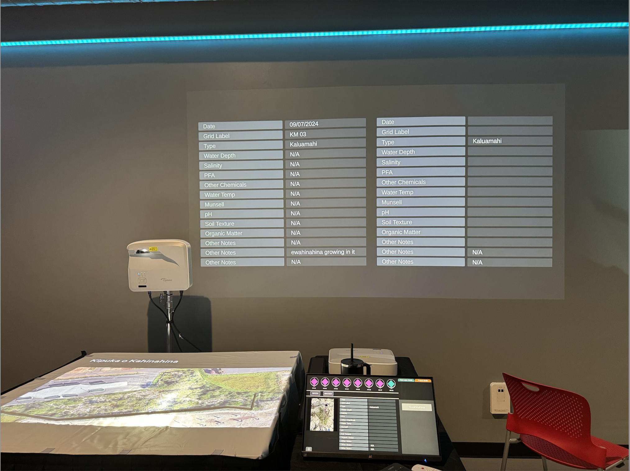
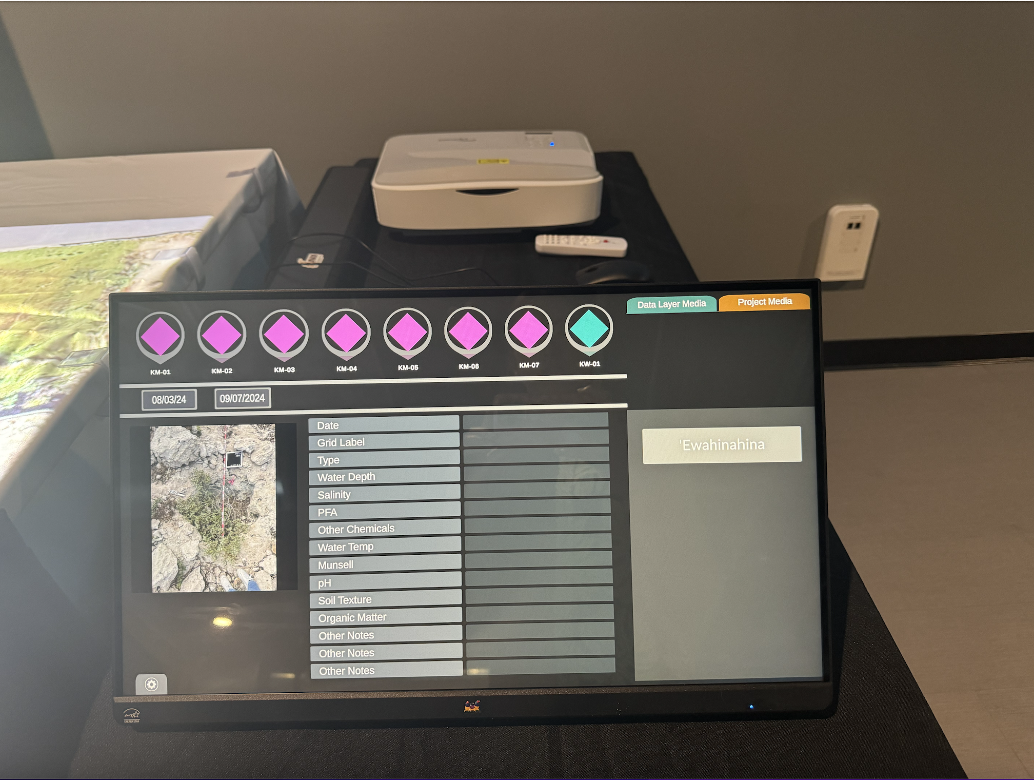
- Data Table Display Layout
- What is it?
- This component is the design and layout of what the data table looks like when it is displayed. The purpose is for the data on each data entry to be displayed in a quick and visually easy to understand way. This is a feature we knew we needed to create and design because without it, there is no way to display the information gathered.
- Contributions
- Assisted with the creation of the first iteration design of the data table display layout and continues to work on it with the changes that will be made to the data collection form in the second iteration.
- What is it?
- Test Data
- What is it?
- This asset consists of data files that were necessary to reference when designing the Data Table Display Layout as well as the comparison feature. These data files consist of dummy data taken out in Kipuka o Kahinahina that are used as JSON files.
- Contributions
- Visited the Kipuka to partake in data collection for gathering dummy data that was then utilized during the design and implementation of the data visualization. Collection of the test data required using and testing the data collection form.
- What is it?
- Culture Component Text and Images
- What is it?
- This feature is made for the user to easily display cultural background information on the back projection, as well as other forms of relevant media, such as possible pictures and videos in the future.
- Contributions
- Wrote out the different cultural articles regarding the context and background of the Kipuka so it can be referenced if the system is utilized as a presentation tool. Collaborated with community partners to refine the writing and capture all the necessary information.
- What is it?
Public Highlights and Media Features
If you’re interested, here are some of the publications and presentations I have been a part of thus far:
Click here to read an article about the fellowship program I am apart of.
Watch my Presentation on the first iteration of the Sinkhole Visualization Project here
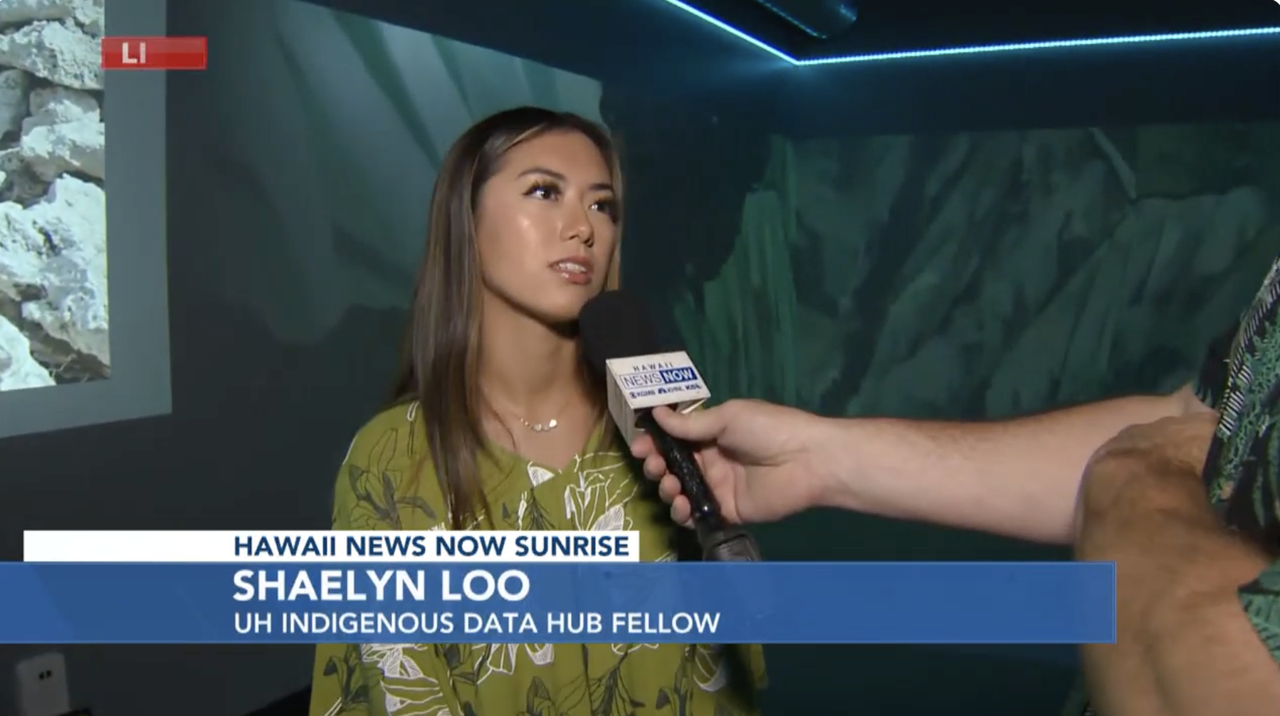
Click here to see my interview with Hawaii News Now.
Click here to see me speak at the University of Hawaii at Mānoa conference, A Catalyst for Change: Indigenous Innovation at UH.